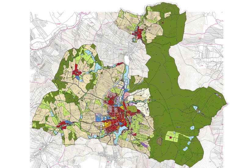
Třešť, with the population approximately 6 000 inhabitants in app. 1 500 houses, is located in
The development of the city is mainly suggested within the current built-up area. We define several new localities mainly on the west. There is a unique section of the city situated along Třešťský Creek which is suitable for the development of greenery or recreational facilities (swimming pool, equitation, playground etc.). A built-up area boundary in Buková, Čenkov and Slavice is conserved. The new zoning plan provides a balance between living, work and recreation and conditions for the sustainable development of the municipality, its infrastructure and surrounding landscape.
- location:
- Třešť, Vysočina Region, CZ
- client:
- Třešť Municipality
- authors:
- Jiří Knesl, Jakub Kynčl, Jan Špirit, Bohuš Zoubek
- project phase:
- completed
- project period:
- ÚP: 2013–2017, Z1: 2020, Z2: 2021, Z3a: 2022
- project area:
- 4 699 ha