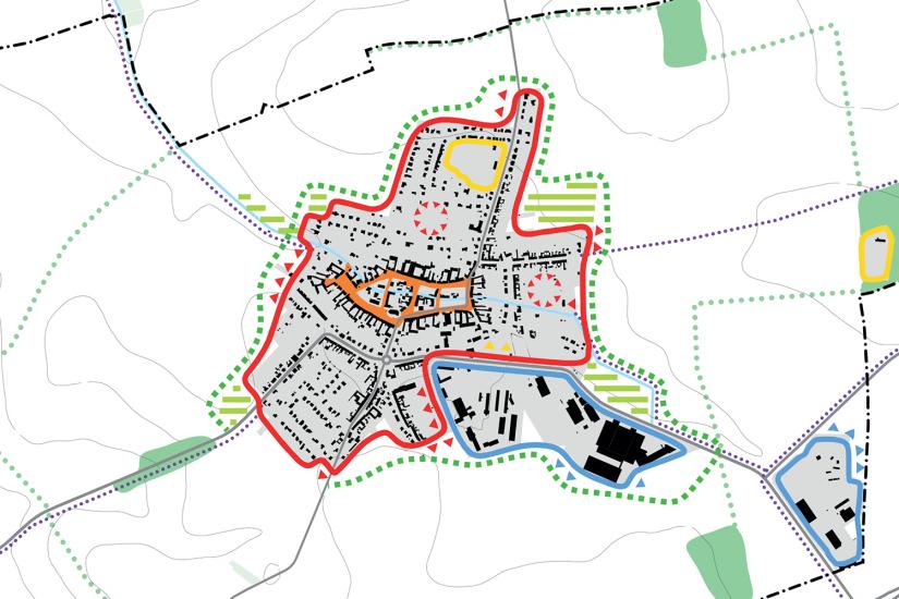
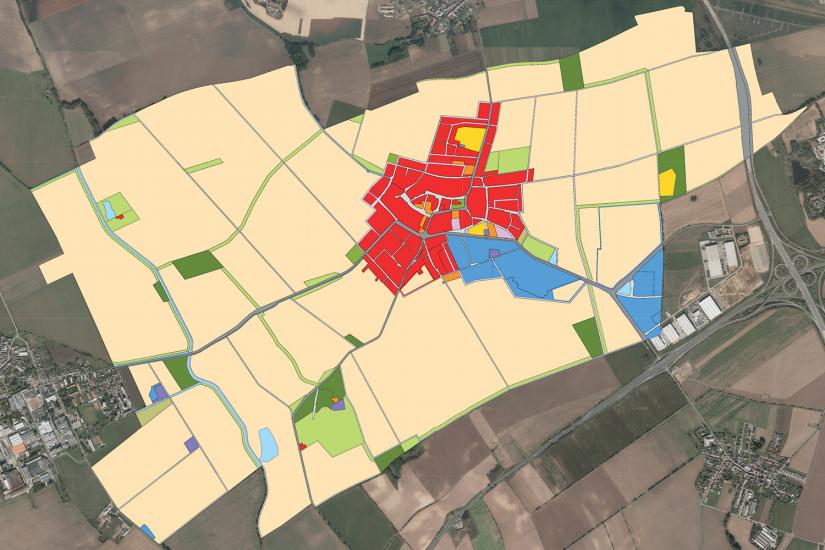
The Hněvotín zoning plan covers the whole administrative area of the small municipality neighbouring Olomouc on its northeastern boundary. The total land area is 1,173 ha. The village finds itself in a fertile agricultural region, therefore farmland is dominant in the landscape and trees or groves are rare. The originally German village now has a population of about 1,800 and considering the available amenities the growth is not expected to surpass 2,000 inhabitants. The plan corresponds to these conditions.
Because the current development has a strong concentric structure, the proposed new building sites are also located mostly inside the village proper and outward growth is minimal. To strengthen the boundary between village and farmland a road with a tree alley extends around the settlement. More new tree alleys are proposed along roads and water features to help break up the legacy of collectivized farming, the monotonous landscape with large fields, and to provide everyday recreation opportunities.
- location:
- Hněvotín, Olomoucký kraj, CZ
- client:
- obec Hněvotín
- authors:
- Jiří Knesl, Jakub Kynčl, Jan Špirit, Bohuš Zoubek
- collaboration:
- Kateřina Polesná / Atelier DPK (DOP), Vítězslav Vaněk (MI), Zdeněk Chudárek / ARKO (EL), Jiří Kocián / AGERIS (ÚSES)
- project period:
- ÚP: 2017–2019, Z1a: 2023
- project area:
- 1 173 ha


