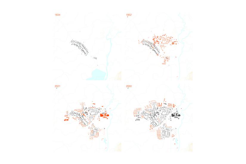
Postřelmov is located in the northernmost tip of Haná in the foothills of the Jeseníky Mountains and still maintains some of its original character. In this it stands out from the surrounding towns, having been the largest purely Czech village in the district after 1848, with a German population never exceeding one percent. Thus, in contrast to other villages in the Sudeten borderland, some continuity of settlement has been preserved.
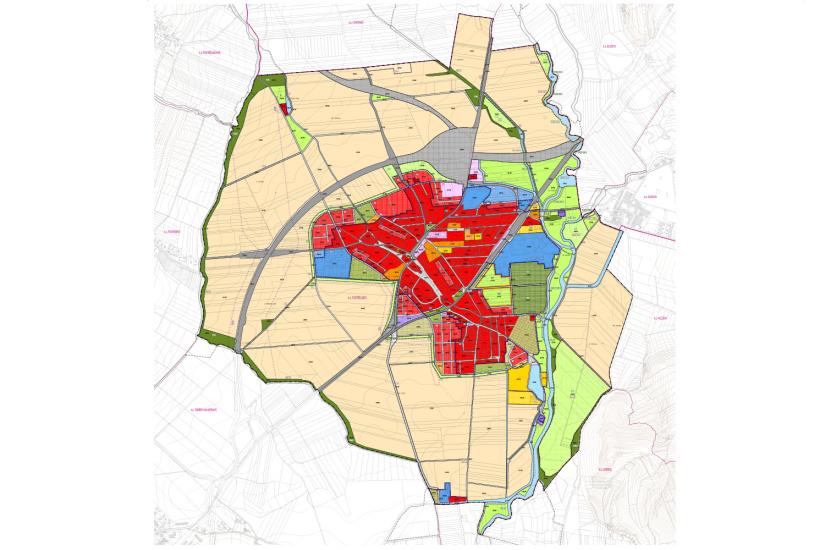
The village lies in a floodplain at the confluence of the Morava and Desná rivers, approximately 5 km northeast of Zábřeh. The administrative territory covers 955 ha and the village has roughly 3,000 inhabitants. The aim of the new zoning plan is primarily to complete the existing structure, which has been marked by haphazard development in the past, to preserve the historic core of the village, to shape settlement in a compact whole, and to define clear boundaries between village and countryside.
Postřelmov is well served by transport, not burdened by transit traffic (the second stage of the bypass is being completed) and has sufficient civic amenities. However, what is missing in this flat agricultural landscape is facilities for everyday recreation. The project therefore includes a recreational walking circuit and a park system. The aim is to create a circular belt of mature greenery linking parks with walking and cycling paths where the settlement and countryside meet. The recreational circuit also includes the Morava River embankment, connecting Postřelmov with the surrounding countryside.
- location:
- Postřelmov, CZ
- client:
- Obec Postřelmov
- authors:
- Jakub Kynčl, Jiří Knesl, Bohuš Zoubek, Jan Špirit
- collaboration:
- Kateřina Mičová Polesná / Atelier DPK (DOP); Vítězslav Vaněk (PL, VHS); Zdeněk Chudárek / ARKO (EL); Jiří Kocián / AGERIS (ÚSES)
- building period:
- 2021-2022
- project area:
- 954,8